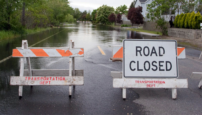
Last night’s storms and continued rain today have saturated the ground in north Missouri. Rivers and streams are full and with nowhere else to go, the accumulating water has collected on some highways, prompting their closure.
Crews from the Missouri Department of Transportation, working with law enforcement and regional emergency services are monitoring many areas for rising waters. Situations can change quickly, especially during flooding. More roads could flood without warning. Motorists are reminded to stay alert and to not drive through any water over the roadway.
It only takes six inches of water (or less!) to lose control of your vehicle and possibly be swept into rising floodwaters. Any time there is water over the roadway, there may be unseen damage to the road surface below. Do not drive through water over a roadway or around construction barricades.
As waters recede and MoDOT crews are able to assess that there is no damage to the road surface from the floodwaters, they will reopen routes to traffic.
To keep up with the latest road closures for flooding, incidents, and roadwork, the Missouri Department of Transportation provides a Traveler Information Map at www.modot.org. Motorists are advised to check the map or call 1-888 ASK MODOT (1-888-275-6636) before heading out to plan alternate routes, as needed.
NOW CLOSED:
Andrew County
- Route 48 on the east side of Rosendale (One Hundred and Two River)
- Route B west of Bolckow (One Hundred and Two River)
- Route C south of Rosendale (One Hundred and Two River)
Chariton County
- Route D one mile west of Route DD (Mussel Fork)
- Route E in Rothville (Yellow Creek)
- Route J south of Dalton
- Route MM west of Dalton
- Route O between Route 129 and Bluegrass Avenue (Bee Branch Creek)
Daviess County
- U.S. Route 69 between Route Z and Route DD (Grand River)
- Route K north of Route P between Grate Avenue and Hope Avenue (Pilot Grove Creek)
- Route Z between Route AA and the Gentry County line (Grand River)
Gentry County
- Route A between Route T and 440th Street (Grand River)
- Route F between U.S. Route 169 and 472nd Road (Grand River)
- Route H from Carmack Junction south to Route E (Grand River)
- Route H north of Berlin (Hickory Creek)
Grundy County
- Route W southwest of Trenton (Hickory Creek)
Harrison County
- U.S. Route 136 from U.S. Route 169 to Route W in Bethany
- Route AA between U.S. Route 69 and Interstate 35 (Big Creek)
- Route ZZ between West 115 Avenue and West 385th Street (Sampson Creek)
Linn County
- Route 139 between Route B and one mile north of Route B (Parsons Creek)
Livingston County
- Route C west of Dawn (Shoal Creek)
- Route KK east of Chula
Nodaway County
- Route AE between Panther Road and Pebble Road (Damaged Culvert)
- Route VV between Route AH and Mercury Road (Platte River)


