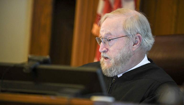
(Missouri Independent) – Residents of five Missouri Senate districts – and perhaps a sixth – will have to wait until this fall to learn if the boundaries will be revised.
At the end of a day-long trial Wednesday, Cole County Circuit Judge Jon Beetem directed attorneys challenging and defending the map drawn last year to submit final briefs by Aug. 15, meaning his ruling is not likely before sometime in September.
In the case, residents of Buchanan County in northwest Missouri and Hazelwood in St. Louis County argue that the map crafted by a panel of judges violates a provision of the Missouri Constitution requiring as few splits as possible of municipalities and counties in the 34-district Senate map.
Secretary of State Jay Ashcroft’s office, which is defending the map, argued that it passes constitutional muster. If it does not, Assistant Attorney General Jeff Johnson argued, the Beetem should make as few changes as possible. Johnson offered an alternative to the plaintiffs’ proposed map that puts all of Hazelwood in a single district but leaves Buchanan County split after minor changes in the boundary.
The decision facing him, Beetem said after denying a request that he rule in favor of Ashcroft, is like cases involving the language that appears on ballots for constitutional amendments and propositions.
“I can write a better ballot summary than you can,” Beetem said, but that is not enough.
In those cases, he said, the question is whether the summary being challenged meets the legal standards for fairness.
Under the one-person, one-vote standard, representative districts should be as close as possible in population.
In this case, the question is whether the current map meets all the requirements of a rewritten legislative redistricting plan adopted by voters in 2020. It is the first case testing which elements must be followed strictly and which are more flexible.
The plan adopted in 2020 requires districts to be within 1% of the ideal population. The difference can be as much as 3% if the district includes entire counties and does not split cities.
For the plaintiffs, represented by attorney Chuck Hatfield, that means only counties with more than enough people for more than one Senate district can be split. And cities can only be split if there is no other way to make a map that has nearly equal populations in each district.
The first priority, under the constitution, intended to “take precedence over any other part of this constitution,” is to make them racially fair. Another priority is that splits of counties “shall each be as few as possible” and that “as few municipal lines shall be crossed as possible.”
The Senate map being challenged splits Buchanan County, which includes St. Joseph, between the 34th and 12th senate districts. The plan submitted by Hatfield would put all of Buchanan County in the 12th District, shift a portion of Clay County from the 21st to the 34th District and shift eight small population counties from the 12th District to the 21st.
Hazelwood is split between the 13th and 14th districts. Hatfield’s proposal would put Hazelwood entirely within the 13th District and shift other small cities and unincorporated territory into the 14th.
That map was prepared by Sean Nicholson. A long-time political activist for progressive causes, Nicholson led a 2018 ballot campaign that made partisan fairness a major factor for redistricting. Republican backlash put the proposal on the 2020 ballot that made following local political boundaries a priority and put partisan fairness as the lowest priority.
Nicholson testified as an expert on redistricting over the objections of Johnson. He said he fell back on what he learned while working to influence House and Senate maps as they were being redrawn in late 2021 and early 2022.
Nicholson admitted that he didn’t know all the mathematical formulas for determining whether districts are compact or other measures. He was trying to find districts that kept counties and cities whole, he said.
“The first and most relevant question is whether (that section) is followed,” Nicholson said.
When Johnson asked for Beetem to exclude the testimony because of a lack of expertise, he declined.
“He is qualified to give the testimony he gave,” Beetem said.
For Johnson and co-counsel Jason Lewis, the question for Beetem is whether the districts are as compact as possible. They brought Sean Trende, a nationally recognized expert on redistricting, to testify.
He told Beetem that the maps proposed as a replacement make the 12th and 34th less compact but that the 21st District would be more compact. He drew a third version of the map that adopts the plaintiffs’ proposal for Hazelwood but shifts a few precincts in Buchanan County to the 12th District from the 34th and Sullivan County from the 12th District to the 18th.
His proposal – one of 5,000 iterations of a Senate map he produced – meets the constitutional requirements. Those changes, Trende said, get the population in the 12th, 18th and 34th districts within 1% of the ideal population of 181,027.
The new map proposal was a surprise. Asked by Hatfield why Ashcroft’s attorneys asked for it, Trende said it was to salvage some sort of victory if Beetem rules against the existing map.
“If the defendants are going to lose,” Trende said, “this is how they prefer to lose.”
(Pool photo courtesy Julie Smith – News Tribune)


