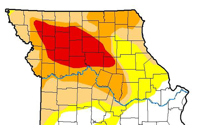
The newest Missouri map from the U.S. Drought Monitor now reports all or portions of 22 counties are considered to be D-3 or extreme drought. The map was released Thursday morning and indicates additional counties have reached the extreme drought status when compared to last week when just 16 counties were regarded as D-3.
The area stretches from Nodaway and Andrew counties on the west to Clinton, Carroll, Chariton, and Randolph counties on the south as far east as Scotland, Adair, Macon, and Randolph. With the exception of the far northeastern Missouri counties, locations close to the Iowa Missouri border remain in moderate to severe drought.
The National Drought Mitigation Center reports an estimated two point four million Missourians are included in the areas impacted by drought.
On Thursday, Governor Mike Parson declared a drought alert for 47 counties in Missouri that are in a severe or extreme drought. Thirty-two of those counties are across northern Missouri, including each of the Green Hills Region counties.
The Governor’s action activated the drought assessment committee and associated drought impact teams. State agencies are directed by the Governor to suspend administrative rules and use resources and other means of support to help communities mitigate the effects of the drought conditions.


