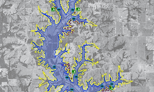
The General Manager of the North Central Missouri Regional Water Commission says there seems to be interest in and discussion about the dam for the East Locust Creek Reservoir.
While the dam has presented challenges, they are not insurmountable. In 2014 after more geologic information was gathered, the proposed dam was moved upstream approximately 170 yards to take advantage of better soil and geology. And, as many who have lived in Sullivan County know, there is a great deal of sand in the soil. Specifically, there are sand lenses, which are basically sand shelves in the substrate. Because sand is permeable, it is sub-optimum for water retention, especially at or near the dam.
While all earthen dams “seep” some water and that seepage is evaluated in the design, too much seepage can damage the integrity of the dam and, well…..it sort of defeats the purpose of the reservoir. In addition, the dam will tie into hills on the east (left) and west (right) side of the dam. These hills also have sand lenses. The good news is that there are engineering, construction and material solutions to address these challenges.
For the dam itself there will be three trenches dug down to bedrock and filled with a malleable, but impermeable cement-like material. They are known as slurry trenches and are very common for earthen dams.
For the hillsides that will have head pressure from the reservoir, they will be cleared of trees and then covered with a stair-step of clay. This “clay curtain” will greatly reduce seepage through the hills.
Statistics About the Dam
Height of Dam = 79’
Length of Dam = 2,650’
Width of Dam at base = Varies, but 600’ max Width of Dam at top = 22’
Slurry trenches are 3’ thick.
Right abutment slurry trench is 1,000 ft long and varies in height from 13’ to 50’. The deepest point in the slurry trench is 54’ below existing ground.
Valley slurry trench Is 1,100’ long and varies from 10’ to 45’ tall. The deepest point in the slurry trench is 45’ below existing ground.
Left abutment slurry trench is approximately 730’ long, and varies in height from 13’ to 34’. The deepest point in the slurry trench is 71’ below existing ground.
The number of borings that informed the location and design of the dam:
40 by NRCS before hiring URS Engineering
107 by URS Engineering
59 by Allstate Consultants
37 test pits dug and tested by Allstate Consultants


