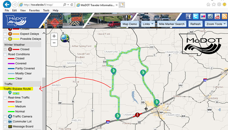
Starting June 9, MoDOT’s Traveler Information Map will have a new feature. The map will be able to display preferred bypass routes whenever there is an incident/congestion on I-44 and I-70.
A bypass will be shown on the map as a green and yellow dashed line with a bypass symbol placed intermittently along the route. A new listing under the “Traffic” heading will appear on the map’s legend located on the left.
“This new application is another tool to assist travelers in finding alternative routes if there is an accident or heavy traffic along two major interstates,” said Susan Summers-Harmon, a traffic operations engineer in MoDOT’s Central District.
MoDOT’s online Traveler Information Map has been helping drivers navigate work zones, snowy roads and flooded routes since 2007. The map provides current traffic conditions and shows real-time traffic flow. MoDOT’s Traveler Information Map is located at www.modot.org. The map is available as a free app for iPhone and Android phones.


