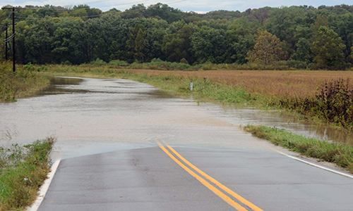
Drier conditions allowed several Northwest Missouri routes to reopen after closing yesterday due to high water. Routes in Carroll, Daviess, and Livingston counties remain closed, however.
Situations can change quickly, especially during flooding. Motorists are reminded to stay alert and to not drive through any water over the roadway. It only takes six inches of water (or less!) to lose control of your vehicle and possibly be swept by rising floodwaters. Any time there is water over the roadway, there may be damage to the road surface below.
To keep up with the latest road closures for flooding, incidents, and roadwork, the Missouri Department of Transportation provides a Traveler Information Map at www.modot.org/northwest.
Motorists are advised to check the map or call 1-888 ASK MODOT (1-888-275-6636) before heading out to plan alternate routes, as needed.
NOW OPEN:
Caldwell County
- Route A between Route O and Applewood Drive south of U.S. Route 36 (Shoal Creek)
- Route N just east of Braymer (Mud Creek)
Carroll County
- U.S. Route 24 south of Carrollton between Route 10 and the Lafayette County Line (Moss Creek)
- Route W east of Roads between Route D and County Road 141 (Turkey Creek)
Daviess County
- Route B from east of Main Street in Coffey to County Road 242 (Hickory Creek)
- Route M northwest of Breckenridge between Waltz Avenue and 302nd Street (Lick Fork Creek)
STILL CLOSED:
Carroll County
- Route 10 between Carrollton and Norborne (Moss Creek)
- Route E north of Norborne between Route D and east of Route PP (Turkey Creek)
Daviess County
- Route UU between Route B east of Coffey and Route P east of Jameson(Big Muddy Creek)
Livingston County
- Route C south of Utica between U.S. Route 36 and Route DD east (Shoal Creek)
- Route D through Ludlow and continuing south to the Carroll County line (Shoal Creek)
- Route DD from Ludlow to Dawn, between Route D & Route C (Shoal Creek)


