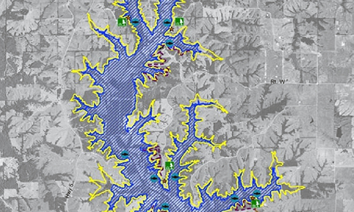
The Project Team for the East Locust Creek Reservoir in Sullivan County will take aerial photos and video of the future lakebed and shoreline this spring.
Drones will be launched from 20 to 30 lake property locations and photos will be taken in the lakebed around 300 feet and at 10 to 20 miles per hour.
The data gathered from the fly-overs will help identify areas that are eroding, vulnerable to erosion, suitable for structures to protect the shoreline, and suitable for fisheries habitats.
The data will enable the Project Team to plan and construct structures that will keep the lake clean and promote the habitat.
The team is working with the Nebraska Game and Parks Department who have experience in lake construction.


